The Appalachians are beautiful but, man are they hard to traverse. I looked at the elevation map last night and it looked to be relatively flat compared to the last few days. I was thinking big miles. By 9:30 I already had 50 miles in the books. I made it to Christiansburg for lunch. Oh! And I remembered this time. Map set 11, “The End”! I am on the last map set, number 12! What a feeling to pull out the last map. I would say I will be glad to not have to look at a map for awhile, but, that is what I do for a living so I will soldier on.
After lunch I began the second half of the day’s ride which I will dub, “The Big Hurt”. I could not believe how many rolling hills you could fit into a 40 mile stretch. I think it was in the thousands! Ok, I am exagerating. I don’t mind the big climbs because you go up once and then down. This was up and down over, and over, and over, and you get the idea. It is hard on the legs. The afternoon beat me down pretty good. Oh! And the only convienent store in the 44 mile stretch was permenently closed. Again, I forgot to look at the addendum. I put the blame on me for that one, I can’t blame Bob, although I would like to.
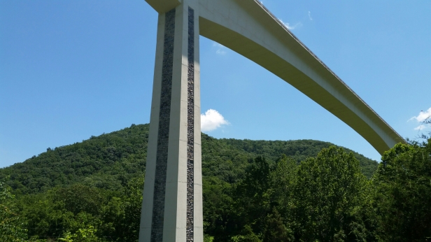
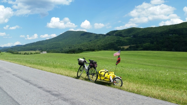
While the misery was playing out I did take the time from the pain to snap some beautiful shots of the mountains. I went under a huge bridge, that to me, was very impressive. I had to take a picture of it. The roadway part, of the bridge, look like it floated in the air. I researched the name of the bridge, just now, for the blog post. I was expecting that it was a Interstate or US highway bridge. Nope. It’s the Virgina Smart Road, aka Smart Road and currently it goes to a dead end! It is used, “for the testing of pavement technologies and as a proving ground for new transportation technologies. The Smart Road is currently a 2.2-mile stretch of road with turn-around loops at either end”. Talk about a bridge to know where!
The Appalachian Trail merged onto the TAT for a very short distance and it so happened I rolled up on a ATer. An ATer is a walking TATer. Just to clear things up. These are my own acronyms by the way. Lol. Ben is from Charleston, SC. Ben is hiking the AT from Maine to Georgia. I asked Ben if he remembers passing though Wind Gap, PA. He did! I told him I live about 10 minutes from the AT crossing in Wind Gap. I did not get a photo, we did not talk long, we were both baking in the Sun.
6 more days!
I am staying at a hotel in Daleville, VA
Day 50 – 93 miles, 43 of them painful.
Total 3,937.2 miles
No videos today.


Wahooooooo!!! Map 12! Back home reading your blogs, it seems like it’s flying by! Home stretch! You got this!!!!!!
LikeLike
Yes! Almost. I can’t wait to see Audrey & Luna again. Thanks Bren.
LikeLike
I’m going to miss reading your blog when it comes to my inbox. Maybe you can run back to CO or paddleboat around the entire U.S. coast next? I read some guy is doing the latter right now from Texas to NYC, and thought maybe you could outdo that wimpy distance too.
LikeLike
Jesus Greg, you are wearing me out man. When I get home I am going to sleep for days. Lol. When I eventually wake, I may consider some other crazy adventure. For now, I just want to get home. Thanks bud.
LikeLike